


Written by andreajn
Modified & Updated: 11 Oct 2024
Reviewed by Jessica Corbett
If you take one look at the Mississippi River on a map, you’d already get an image of its vastness. Aside from its size, the Mississippi River role in ecology places it among the major river systems in the world. Learn more of the wonders of one of the world’s longest rivers with these Mississippi River facts.
- The Mississippi River drains about 40% of the U.S., equivalent to 1.2 million sq mi in total.
- It is equivalent to about ⅛ of the entire continent.
- A single drop of water would take 90 days to travel the length of the Mississippi River.
- About 18 million people from over 50 cities rely on the river for daily water supply.
- The Mississippi River drops 1,475 ft from its source down to the Gulf of Mexico.
- The entirety of the Mississippi River lies within the U.S.
- Its main body and tributaries drain at least 30 U.S. states and 2 provinces in Canada.
- Over 170 bridges span the Mississippi River.
- The Mississippi River is the cheapest way to travel between the Southern and Eastern U.S.
- This river makes the 4th largest drainage basin of the world.
- The first bridge over the Mississippi River was set up in 1855.
- The Mississippi River played a key role in the Civil War victory over the Confederacy.
- This river provides hydroelectric power to more than 50 cities every day.
- Famous stories by American writer Mark Twain either take place or relate to the river.
- The Adventures of Huckleberry Finn is an excellent example of his work.
- Before the Louisiana Purchase in 1803, Britain, France, and Spain all claimed land bordering the river.
- The Mississippi River is home to over 260 fish species or 25% of all fish species in North America.
- It caters to 50 mammal species, 145 amphibian species, and 325 bird species as well.
- In 2002, it took Slovenian swimmer Martin Strel 68 days to swim the length of the river.
- The Mississippi River birthed the sport of water-skiing.
Mississippi River Facts Infographics

The name ‘Mississippi’ means “Father of Waters.”
The Mississippi River owes its name to the Anishinabe people, also known as the Ojibwe Indians. The Anishinabe called the river Messipi or Mee-zee-see-bee, which translates to ‘Big River.’
Meanwhile, the Dakota Indians refer to the river as “Hahawakpa.” This translates to “River of the Falls,” referencing the falls currently known as the Falls of St. Anthony.
The Mississippi River ranks as the 4th longest river in the world.
If you add the length of the Missouri-Jefferson (also known as Red Rock) system to the Missouri-Mississippi junction, it can pass as the third-longest river in the world. When combined, the rivers span a total length of 3,710 miles (5,971 km).
The Mississippi River is the second-longest river in the U.S.
Overall, the River Mississippi stretches up to 2,340 miles. On the other hand, it has a rough volume of discharge rate of 600,000 cubic ft (17,000 cubic m). This makes it only second to the Missouri River.
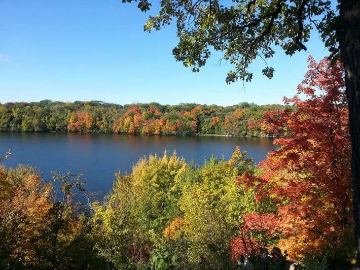
The Mississippi River starts in Minnesota.
From Lake Itasca, MN, the river flows almost due south across the continent’s interior. Some of its major tributaries are the Missouri River to the west and the Ohio River to the east.
Through a broad delta southeast of New Orleans, it meets the river proper halfway to the Gulf of Mexico.
At its narrowest, the Mississippi River stretches about 20 to 30 ft wide.
The Mississipi River’s narrowest point lies near Lake Itasca. On the other hand, the Mississippi’s widest point is at Lake Winnibigoshish near Bena, MN, stretching over 11 miles.
The Mississippi River runs less than 3 ft deep at its origin.
However, it has depths of a 200 ft maximum in New Orleans. This part flows from Governor Nicholls Wharf to the Algiers Point.
The Mississippi River has the most connections in North America.
As impressive as the river’s size is, it also stands out for its connection to all the other rivers contributing to its journey towards the Gulf of Mexico. The Mississippi River’s extensive watershed sprawls from the Rocky Mountains in the west to the Appalachian Mountains in the east.
The Great River Road runs alongside the Mississippi River.
Created in 1938, the highway is an assembly of state and local roads. It follows the course of the world’s 4th longest river, trailing through 10 states of the U.S.
The Mississippi River flowed backward in August 2012.
During Hurricane Isaac, the Mississippi River flowed backwards. This natural phenomenon lasted for 24 hours. Upriver, the flow reached about 5,200 cu m/s (182,000 cu ft/s) and a height of roughly 3 m (10 ft) above average.
Otherwise, it normally flows at an average of 3,540 cu m/s in the opposite direction.
Another instance of the river’s backward flow was in 2005.
During Hurricane Katrina, the Mississippi River rose to a height of 4 m (13 ft) above normal. Another potential cause for such phenomena is earthquakes like what happened near the New Madrid fault in Missouri in 1812.
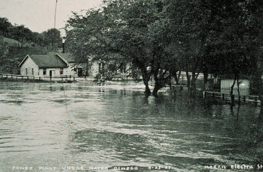
The Mississippi River flooding marked history as the Great Flood of 1927.
In April 1927, the overflowing of the lower Mississippi River valley submerged over 23,000 sq mi (60,000 sq km) of land. The flooding caused the displacement of hundreds of thousands of people as well as 250 casualties.
The Mississippi River flooding triggered long-term social and political changes in the U.S.
With the way the administration handled the Mississippi River flooding, Black Americans made a switch in political loyalty. The community largely shifted their support from the anti-slavery Republican Party of then-U.S. President Calvin Coolidge to the Democratic Party.
Aside from that, the Great Migration of Black Americans transpired from the South to the North.
The Mississippi River stages serve as safety warnings for potential flooding.
River stages refer to the height of the river’s surface relative to the standard sea level. Some reports tell of a subjective benchmark point instead. Often, the basis for these stages are historical events in the local area or reported river practices from decades past.
There 4 different Mississippi River levels are also known as reaches or sections.
The Mississippi River’s headwaters trace back to the head of navigation at St. Paul, Minnesota. There, the river flows into a clear, fresh stream that winds through the low countryside with scattered lakes and marshes.
The upper section of the Mississippi River stretches from St. Paul to the mouth of the river near St. Louis, Missouri.
The middle part of the Mississippi River lies below the Missouri River conjunction.
Following a 200 mile (320 km) course, it flows down to the mouth of the Ohio River. This part of the Missouri has turbulent, cloudy to muddy, waters.
Hence, this part adds impetus and hefty amounts of silt into the clearer waters of the Mississippi River when it floods.
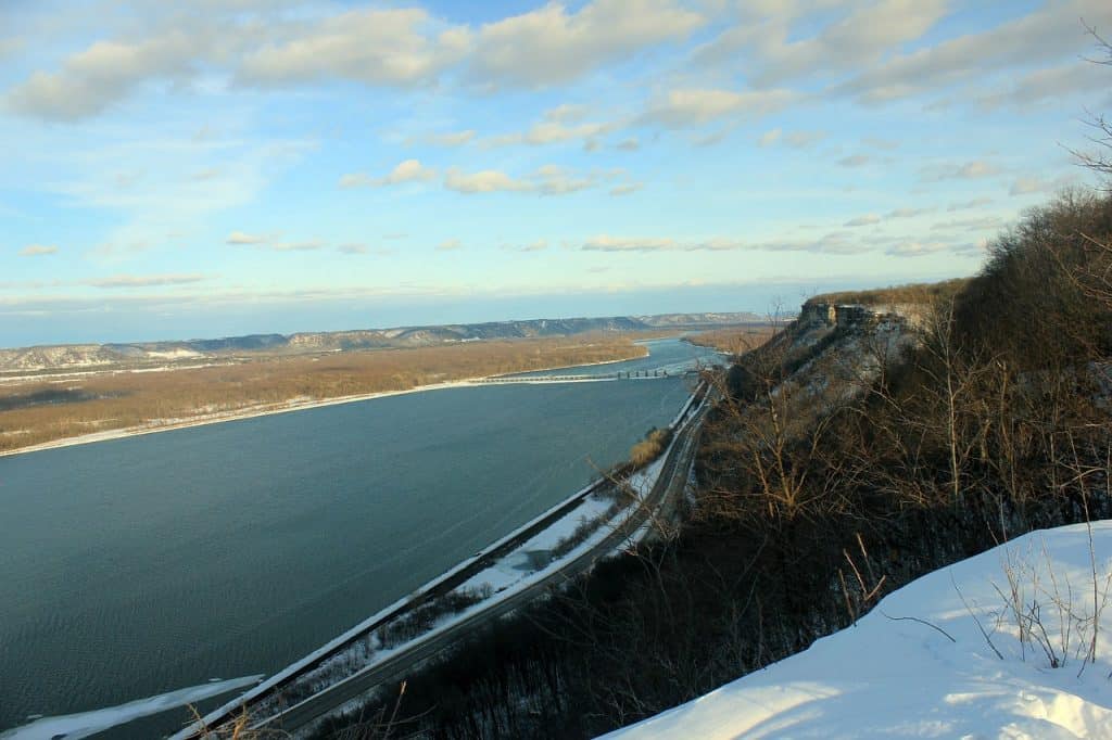
The Lower Mississippi lies beyond the junction with the Ohio River at Cairo, Illinois.
Due to the larger size of the Ohio River, the Mississippi River swells to double its size at this point. The lower Mississippi shifts into a brown, lazy river with an average of 1.5 miles (2.4 km) from bank to bank. From there, it descends quietly towards the Gulf of Mexico.
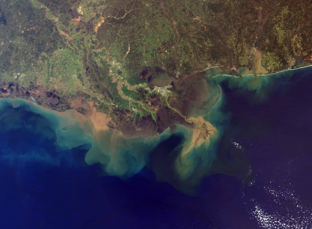
The Mississippi River delta boasts of millions of years of sedimentation
Lying at the tip of the drainage funnel, the Mississippi River Delta has spilled across the floor of the Gulf of Mexico. The Mississippi River delta also formed cones of sediment summing up to 300 mi in radius and 30,000 sq mi (77,700 km) in area.
In 2003, the Mississippi River Museum opened in Dubuque, Iowa, USA.
By 2010, this museum had doubled the size of its own campus. The Mississippi River Museum is a premiere center for the study and conservation of the river’s historical and natural environment. Serving a global audience, the museum stands as the leading cultural and environmental facility in the region as well.
The Mississippi River Museum boasts many accreditations.
Since its establishment, the Mississippi River Museum has received accreditation from the American Association of Museums.
In 2002, the Museum & Aquarium became a Smithsonian Institute. It even gained delegation from the Association of Zoos & Aquariums in 2009 as well.
The Mississippi River cruise has at least 2 different courses.
First, the Upper Mississippi River Cruise covers the area between St. Louis, Missouri, and St. Paul, Minnesota. On the other hand, the Lower Mississippi River Cruise sails Memphis, Tennessee, and New Orleans, Louisiana. Moreover, cruises through the river’s tributaries like the Ohio, and Tennessee Rivers are also available.
Was this page helpful?
Our commitment to delivering trustworthy and engaging content is at the heart of what we do. Each fact on our site is contributed by real users like you, bringing a wealth of diverse insights and information. To ensure the highest standards of accuracy and reliability, our dedicated editors meticulously review each submission. This process guarantees that the facts we share are not only fascinating but also credible. Trust in our commitment to quality and authenticity as you explore and learn with us.