


Written by Lilas Yanez
Modified & Updated: 30 Nov 2024
Reviewed by Sherman Smith
Cartography, the science and art of creating maps, has a fascinating history that spans centuries. From early civilizations sketching rudimentary maps to the advanced technology used in modern digital cartography, the work of cartographers has allowed us to navigate the world and understand its complexities. In this article, we will uncover 18 astounding facts about cartographers and their craft. We will delve into the intriguing stories behind their map-making techniques, explore the secret tools they use, and discover how cartography has contributed to our understanding of the world. So, get ready to be amazed as we unveil these surprising facts about the unsung heroes behind the maps we use every day.
Key Takeaways:
- Cartographers are skilled professionals who create maps using a blend of science and art, helping us navigate the world and contribute to various fields like urban planning and conservation.
- With advancements in technology, cartographers now use satellite imagery and three-dimensional mapping techniques to produce accurate and visually engaging maps, playing a crucial role in disaster management and space exploration.
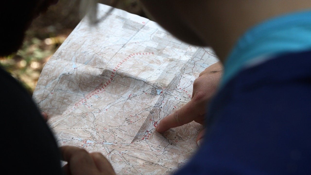
Cartographers create maps.
Cartographers are skilled professionals who specialize in the science and art of creating maps. They gather data, interpret geographic information, and use advanced software and tools to produce accurate and detailed maps.
Cartographers utilize various techniques.
To accurately represent the physical features of the Earth, cartographers employ a range of techniques such as aerial photography, satellite imagery, GPS data, and surveying to gather precise information.
Maps have been created for thousands of years.
Cartography has a long history that dates back to ancient civilizations. From the Babylonians and Egyptians to the Greeks and Romans, early cartographers used rudimentary techniques to depict the world around them.
Cartographers help us navigate and understand the world.
By developing maps, cartographers enable us to navigate unfamiliar territories, plan routes, and gain a better understanding of the spatial relationships between different areas.
Cartography is a blend of science and art.
Cartographers use scientific methods to gather data and create accurate representations of the Earth’s features, but they also rely on artistic skills to present information in a visually appealing and easily understandable manner.
Cartographers contribute to multiple fields.
The work of cartographers is not limited to creating maps. They also provide vital geographic information to urban planners, environmental scientists, geologists, and even military strategists.
Advancements in technology have revolutionized cartography.
The advent of computer software, Geographic Information Systems (GIS), and remote sensing technologies has significantly enhanced the efficiency and precision of cartographic work.
Cartographers consider various map projections.
Due to the challenge of representing a three-dimensional surface on a two-dimensional map, cartographers use different map projections to minimize distortions in size, shape, distance, and direction.
Satellite imagery helps create up-to-date maps.
With the help of satellite imagery, cartographers can capture real-time data and updates, ensuring that maps reflect the most current information about the Earth’s ever-changing landscape.
Cartography plays a crucial role in disaster management.
During natural disasters and emergencies, cartographers provide critical information to aid in rescue operations, evacuation planning, and assessing the impact of the event.
Maps can be used for storytelling.
Cartographers have the ability to create thematic maps that visualize historical events, demographic trends, or even fictional narratives, helping us explore and understand the world from different perspectives.
Cartographers contribute to conservation efforts.
By mapping ecological features, biodiversity hotspots, and endangered species habitats, cartographers assist in identifying areas that require protection and aid in environmental conservation efforts.
Cartographers map beyond Earth.
Cartographic techniques are not limited to Earth. Cartographers also create maps of other celestial bodies, such as the Moon, Mars, and other planets, to aid in space exploration.
Three-dimensional mapping is becoming more common.
With advancements in technology, cartographers are increasingly using three-dimensional mapping techniques to produce more immersive and realistic representations of the Earth’s surface.
Cartographers collaborate with other professionals.
Cartographers often work closely with geographers, surveyors, geologists, urban planners, and other professionals to gather data and ensure accurate and comprehensive map production.
Cartography is an evolving field.
New technologies, data sources, and mapping techniques are constantly being developed, keeping the field of cartography exciting and continuously pushing the boundaries of what is possible.
Cartographers are skilled at visual communication.
Cartographers utilize their understanding of design principles, color theory, and typography to create visually engaging maps that effectively communicate information to the intended audience.
Cartographers play a vital role in urban planning.
By mapping land use, transportation networks, and infrastructure, cartographers assist in urban planning processes, contributing to the development of sustainable and well-designed cities.
Conclusion
Cartographers play a crucial role in helping us understand the complex world we live in. From ancient times to modern technology, their skills and knowledge have contributed to the development of accurate maps that have shaped our understanding of geography, navigation, and exploration. Whether it’s creating maps for scientific research, urban planning, or simply for our own curiosity, cartographers continue to amaze us with their skillful craft.
As we delve deeper into the world of cartography, we discover fascinating facts about the history, techniques, and impact of this noble profession. From the intricacies of map-making to the significance of projections, cartographers have an awe-inspiring wealth of knowledge that enriches our understanding of the world in ways we may not have imagined.
So next time you look at a map, take a moment to appreciate the work of cartographers and the incredible journey it took to create that visual representation of our world.
FAQs
Q: What skills are required to become a cartographer?
A: To become a cartographer, you need a strong background in geography, spatial analysis, and graphic design. Proficiency in Geographic Information Systems (GIS) software and a keen eye for visual representation are also essential.
Q: What tools do cartographers use?
A: Cartographers use a variety of tools, including computer software for mapping and data analysis, satellite imagery, aerial photographs, and traditional drawing tools such as pens, pencils, and rulers.
Q: How do cartographers ensure accuracy in their maps?
A: Cartographers employ various methods to ensure accuracy, such as ground surveys, remote sensing techniques, and verification through multiple data sources. They constantly update and revise their maps to reflect the most recent and accurate information available.
Q: What is the significance of projections in cartography?
A: Projections help cartographers represent the three-dimensional Earth on a two-dimensional map. Different projections have different strengths and weaknesses, and cartographers carefully choose the most appropriate projection based on the purpose of the map and the area being represented.
Q: How has technology impacted the field of cartography?
A: Technology has revolutionized cartography, enabling cartographers to create digital maps with greater precision and ease. Geographic Information Systems (GIS) software, satellite imagery, and GPS technology have all played a significant role in advancing the field.
Cartographers' fascinating world extends beyond creating maps. Delving into cartographic techniques reveals a wealth of knowledge waiting to be explored. Astrology enthusiasts will find Pisces facts equally captivating, offering a glimpse into the zodiac's mysterious depths. For those seeking a lighthearted adventure, "The Englishman Who Went up a Hill But Came Down A Mountain" provides an entertaining escape with its quirky premise and memorable characters. Each topic invites readers to embark on a unique journey of discovery, whether through the intricacies of mapmaking, the enigmatic nature of astrological signs, or the charm of a delightful cinematic tale.
Was this page helpful?
Our commitment to delivering trustworthy and engaging content is at the heart of what we do. Each fact on our site is contributed by real users like you, bringing a wealth of diverse insights and information. To ensure the highest standards of accuracy and reliability, our dedicated editors meticulously review each submission. This process guarantees that the facts we share are not only fascinating but also credible. Trust in our commitment to quality and authenticity as you explore and learn with us.