When it comes to mapping the world, cartographic techniques have played a pivotal role in providing accurate and detailed representations of our planet. These techniques have evolved over time, from the simple drawings on cave walls to the advanced digital mapping systems we have today. The field of cartography encompasses a wide range of methods and tools that are continuously being refined to capture the complexity of our diverse and ever-changing world.
In this article, we will delve into the fascinating world of cartographic techniques and explore nine astounding facts that highlight the ingenuity and creativity behind the art of mapmaking. From ancient mapping methods to modern technological advancements, these facts will showcase the remarkable achievements in the field of cartography and the impact they have on our understanding of geography.
Key Takeaways:
- Cartographic techniques have evolved from cave drawings to digital mapping, helping us navigate and understand the world better.
- From ancient Greeks to modern GPS, cartography has shaped disaster management, urban planning, and environmental conservation. It continues to advance with technology.
Cartographic techniques have evolved over thousands of years.
From the ancient maps drawn on cave walls to the sophisticated digital mapping systems used today, cartography has come a long way in its methods and tools.
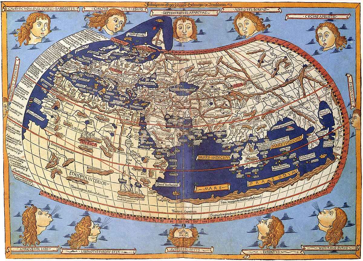
The ancient Greeks and Romans were pioneers in cartographic techniques.
They developed early map projections and methods of measuring distances, laying the foundation for modern cartography.
The Mercator projection is one of the most widely used cartographic techniques.
Named after Gerardus Mercator, this cylindrical map projection preserves angles and shapes, but distorts areas near the poles.
GPS technology has revolutionized cartographic techniques.
Global Positioning System (GPS) allows for precise mapping and navigation, making it easier to create accurate and detailed maps.
Cartographic techniques are crucial for disaster management.
During natural disasters, mapping methods such as remote sensing and GIS (Geographic Information System) help emergency responders assess affected areas and plan rescue operations.
Cartographic techniques are used in urban planning and development.
By mapping out cities and regions, cartographers assist in designing infrastructure, managing resources, and improving overall urban environment.
Cartographic techniques play a vital role in environmental conservation.
By mapping habitats, ecosystems, and land use patterns, cartographers help identify areas of ecological significance and plan conservation efforts accordingly.
The use of aerial photography has greatly influenced cartographic techniques.
Aerial imagery provides detailed and accurate visual data, enabling cartographers to create high-resolution maps and analyze landscapes more effectively.
Cartographic techniques continue to evolve with advancements in technology.
The integration of artificial intelligence, virtual reality, and augmented reality into mapping systems is shaping the future of cartography, offering new possibilities and insights.
Conclusion
Cartographic techniques are fascinating and play a vital role in our understanding of the world around us. From ancient times to modern advancements, cartographers have developed innovative methods to represent Earth’s features accurately and efficiently. The evolution of cartography has led to remarkable discoveries and advancements in various fields.
From the use of aerial photography and satellite imagery to digital mapping and geographic information systems (GIS), cartographers have expanded their toolset and transformed how we perceive and navigate our world. Their expertise and creativity have revolutionized the way we view and interpret geographic data.
Whether it’s creating detailed topographic maps, charting ocean currents, or visualizing urban planning projects, cartographic techniques have become indispensable in numerous industries and academic disciplines. Understanding these techniques help us appreciate the complexity and artistry behind the maps we use every day.
FAQs
Q: What are cartographic techniques?
A: Cartographic techniques refer to the methods and processes used to create maps and charts. These techniques involve collecting and analyzing geographical data, selecting appropriate map projections, symbolization, and design principles to represent information accurately.
Q: How have cartographic techniques evolved over time?
A: Cartographic techniques have evolved significantly from hand-drawn maps to highly advanced digital mapping technologies. With advancements in technology, cartographers now utilize satellite imagery, aerial photography, and geographic information systems (GIS) to create more accurate and detailed maps.
Q: What is the importance of cartographic techniques?
A: Cartographic techniques are crucial for understanding spatial relationships, analyzing patterns, and making informed decisions. Maps created using these techniques help us navigate, plan routes, study geographic features, visualize data, and support various industries, including transportation, urban planning, environmental science, and archaeology.
Q: How do cartographers choose map projections?
A: Cartographers choose map projections based on the purpose of the map and the area being represented. Different projections maintain certain properties while distorting others. Some projections are better suited for global maps, while others are more appropriate for regional or thematic maps.
Q: Are cartographic techniques only used for creating physical maps?
A: No, cartographic techniques are used for creating various types of maps, including physical maps, political maps, thematic maps, and interactive digital maps. These techniques are also employed in creating maps for navigation systems, GPS devices, and online mapping platforms.
Was this page helpful?
Our commitment to delivering trustworthy and engaging content is at the heart of what we do. Each fact on our site is contributed by real users like you, bringing a wealth of diverse insights and information. To ensure the highest standards of accuracy and reliability, our dedicated editors meticulously review each submission. This process guarantees that the facts we share are not only fascinating but also credible. Trust in our commitment to quality and authenticity as you explore and learn with us.
