
Written by Nonah Gomez
Modified & Updated: 05 Mar 2024
Reviewed by Jessica Corbett
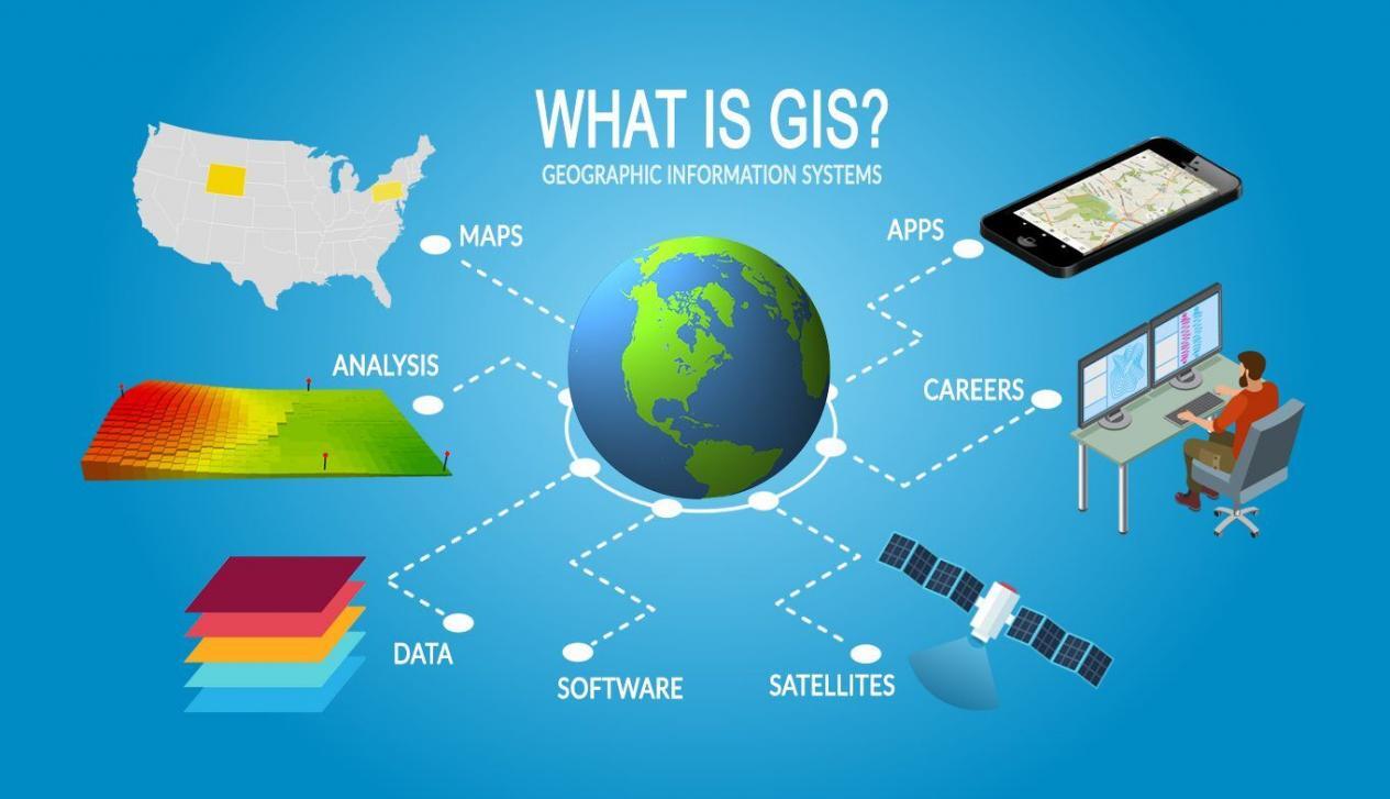
Geographical Information Science, also known as GIScience, is a fascinating field that combines technology, geography, and data analysis to understand and analyze complex spatial information. From mapping and navigation to urban planning and environmental management, GIScience plays a crucial role in various disciplines and industries.
In this article, we will delve into 12 surprising facts about Geographical Information Science that will not only broaden your knowledge but also highlight the significant impact it has on our everyday lives. From its origins and applications to its continuous evolution and future potential, you will discover the remarkable contributions of GIScience and why it remains an essential field in the modern world.
Key Takeaways:
- GIScience is like a superhero that helps in disaster management, urban planning, archaeology, and even wildlife conservation. It uses spatial data to make the world a better place!
- Imagine GIScience as a magical map that guides us in finding the best routes, managing natural resources, and even understanding disease patterns. It’s like having a superpower for understanding our world!
GIScience is a multidisciplinary field.
Geographical Information Science, or GIScience, is an academic field that combines various disciplines such as geography, computer science, cartography, and remote sensing. It focuses on the study of spatial data, analysis, and visualization, providing valuable insights in fields like urban planning, environmental management, and transportation logistics.
It helps in disaster management.
GIScience plays a crucial role in disaster management by providing accurate spatial data and analytical tools. It allows professionals to make informed decisions about evacuation routes, resource allocation, and emergency response strategies. By analyzing real-time data, GIScience helps in assessing the impact of natural disasters and aids in effective disaster recovery efforts.
GIScience is used in archaeology.
Archaeologists use GIScience to map, analyze, and interpret historical and cultural sites. By integrating spatial data with archaeological data, researchers can gain insights into the spatial relationships between artifacts, settlements, and ancient landscapes. This helps in understanding patterns of human activity and cultural evolution over time.
It enhances urban planning.
GIScience plays a crucial role in urban planning by providing tools for data visualization, scenario modeling, and decision-making. It helps in analyzing factors like population growth, land use patterns, transportation networks, and infrastructure planning. By considering various spatial variables, GIScience aids in creating sustainable and livable cities.
GIScience is used in location-based services.
GPS technology and GIScience are integrated to provide location-based services like navigation, geotagging, and location tracking. These services are widely used in mobile applications ranging from map apps to ride-sharing services. GIScience enables the seamless integration of spatial data and real-time location information to enhance user experience.
It contributes to environmental management.
GIScience is instrumental in managing and monitoring the environment. It helps in tracking deforestation, analyzing habitat suitability, predicting climate change impacts, and identifying areas prone to natural disasters. By understanding spatial relationships, GIScience aids in making informed decisions for biodiversity conservation and sustainable resource management.
GIScience is used in transportation planning.
GIScience plays a vital role in transportation planning by providing tools for route optimization, traffic analysis, and logistics management. By analyzing spatial data such as traffic patterns, road networks, and commuting behavior, GIScience helps in improving transportation efficiency, reducing congestion, and enhancing overall mobility.
It aids in crime analysis.
Law enforcement agencies use GIScience to analyze crime patterns, hotspots, and response times. By integrating spatial data with crime data, GIScience helps in identifying crime trends, allocating resources effectively, and developing targeted crime prevention strategies. It enables law enforcement agencies to make data-driven decisions for enhancing public safety.
GIScience is used in natural resource management.
GIScience plays a crucial role in managing natural resources such as forests, water bodies, and mineral deposits. By analyzing spatial data, it helps in identifying optimal locations for resource extraction, assessing environmental impacts, and planning for sustainable resource utilization. GIScience aids in balancing economic development with environmental conservation.
It contributes to public health research.
GIScience is used in public health research to analyze disease patterns, identify high-risk areas, and assess access to healthcare facilities. By integrating spatial data with health data, GIScience helps in understanding the spatial distribution of diseases, planning disease surveillance, and improving healthcare service delivery.
GIScience supports precision agriculture.
GIScience is utilized in precision agriculture to optimize farming practices. By analyzing spatial data such as soil composition, climate conditions, and crop yield variability, GIScience helps in site-specific farming techniques, precision irrigation, and targeted fertilizer application. This leads to improved agricultural productivity and resource efficiency.
It aids in wildlife conservation.
GIScience is instrumental in wildlife conservation efforts. By analyzing spatial data, researchers can study habitat suitability, migratory patterns, and biodiversity hotspots. GIScience helps in identifying critical areas for conservation, designing protected areas, and monitoring wildlife populations. It plays a vital role in preserving biodiversity and ensuring the sustainable management of natural ecosystems.
Conclusion
In conclusion, the field of Geographical Information Science (GIScience) is a fascinating and rapidly growing discipline that encompasses a wide range of applications and technologies. Throughout this article, we have explored 12 surprising facts about GIScience that highlight its importance and impact on various aspects of our lives.From improving urban planning and disaster management to enabling location-based services and environmental monitoring, GIScience plays a crucial role in enhancing our understanding of the world around us. It combines geospatial data, advanced analytics, and visualization techniques to provide valuable insights and support informed decision-making.As technology continues to evolve, the possibilities for GIScience are endless. It holds great potential for addressing complex spatial problems and driving innovation across industries. Whether you’re interested in mapping, remote sensing, or spatial analysis, exploring the field of GIScience can open up a world of opportunities and help shape a more sustainable and connected future.Investing in GIScience education and embracing its applications can empower individuals and organizations to leverage the power of spatial information for better decision-making and problem-solving. By harnessing the power of GIScience, we can unlock new perspectives and create a more resilient and equitable world.
FAQs
Q: What is Geographical Information Science (GIScience)?
A: Geographical Information Science, also known as GIScience, is an interdisciplinary field that combines geography, computer science, and spatial analysis to study and understand the relationships between people, places, and the environment.
Q: What are some common applications of GIScience?
A: GIScience has numerous applications across various industries, including urban planning, transportation management, environmental analysis, climate change research, disaster management, market analysis, and public health.
Q: How does GIScience contribute to urban planning?
A: GIScience helps urban planners analyze and visualize data related to population, transportation, land use, infrastructure, and other factors. This information enables them to make informed decisions, optimize resource allocation, and improve the quality of life in cities.
Q: Can GIScience be used for environmental monitoring?
A: Yes, GIScience plays a crucial role in environmental monitoring by integrating data from various sources such as satellite imagery, weather stations, and sensors. It helps researchers and policymakers track changes in ecosystems, monitor biodiversity, and assess the impact of human activities on the environment.
Q: Is GIScience only limited to geographers and scientists?
A: No, GIScience has applications across diverse fields and is not limited to geographers and scientists. Professionals from disciplines such as urban planning, engineering, architecture, public health, social sciences, and business can benefit from understanding and utilizing GIScience.
Was this page helpful?
Our commitment to delivering trustworthy and engaging content is at the heart of what we do. Each fact on our site is contributed by real users like you, bringing a wealth of diverse insights and information. To ensure the highest standards of accuracy and reliability, our dedicated editors meticulously review each submission. This process guarantees that the facts we share are not only fascinating but also credible. Trust in our commitment to quality and authenticity as you explore and learn with us.