


Ever wondered what makes Panama so unique? This Central American gem, nestled between the Caribbean Sea and the Pacific Ocean, offers a rich tapestry of history, culture, and natural beauty. With a population of around 4.3 million, nearly half reside in the bustling capital, Panama City. Known for the iconic Panama Canal, this nation plays a pivotal role in global trade. But there's more to Panama than its engineering marvel. From its diverse wildlife and lush national parks to its vibrant festivals and historical landmarks, Panama is a treasure trove waiting to be explored. Dive into these 50 facts to uncover the magic of Panama!
Key Takeaways:
- Panama is a unique country that connects North and South America, with a diverse population and a vibrant capital city. Its economy is driven by the famous Panama Canal and a mix of cultural influences.
- With a rich history, natural beauty, and quirky facts, Panama offers a blend of geographical wonders, cultural diversity, and fascinating historical firsts. It's a country full of surprises and unique experiences.
Location and Geography
Panama is a fascinating country with a unique geographical position that bridges two continents. Let's dive into some intriguing facts about its location and geography.
- Panama is situated on the Isthmus of Panama, a narrow land bridge connecting North and South America.
- The country is bounded by the Caribbean Sea to the north and the Pacific Ocean to the south.
- Its elongated S shape stretches approximately 800 miles along the Caribbean coastline and 1,060 miles along the Pacific coast.
- Panama's total land area is 75,417 square kilometers.
Population and Capital City
Panama's population and its vibrant capital city are central to its identity. Here are some key details.
- As of 2024, Panama's estimated population is 4,307,000.
- Nearly half of Panama's inhabitants reside in the capital city, Panama City.
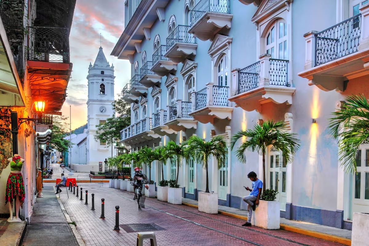
- Panama City is located on the Pacific coast and is known for its modern skyscrapers and historical landmarks.
Official Language
Language plays a crucial role in Panama's culture and communication.
- The official language of Panama is Spanish, spoken by the vast majority of the population.
- English is also widely understood, especially in tourist areas and business sectors.
Government and Society
Panama's political structure and societal norms shape its governance.
- Panama is a multiparty republic with a single legislative house, the National Assembly, consisting of 71 members.
- The country has a president who serves as both the head of state and government.
- The current president is José Raúl Mulino.
Economy
Panama boasts a diverse and robust economy, driven by various sectors.
- A significant portion of Panama's GDP comes from services like the Panama Canal, free trade zones, ports, banking, commerce, and tourism.
- The country exports bananas, shrimp, sugar, coffee, and clothing.
- Panama also manufactures aircraft parts.
Currency
Panama's currency system is unique and reflects its historical ties.
- Panama uses the U.S. dollar as its official currency, adopted in 1904.
- The Balboa is also an official currency, named after Vasco Núñez de Balboa.
Panama Canal
The Panama Canal is one of the most significant engineering feats in history.
- Completed in 1914, the canal connects the Atlantic and Pacific Oceans.
- The canal provides a shortcut for shipping, making Panama a crucial hub in international trade.
- The canal generates fully one-third of Panama's entire economy.
History
Panama's rich and complex history has shaped its present.
- Panama was the first Spanish colony on the Pacific.
- It served as a staging point for the Spanish conquest of the Inca empire in the 1530s.
- After gaining independence from Spain in 1821, Panama became part of Colombia until it declared independence again in 1903.
Cultural Influences
Panama enjoys a lively mix of cultural influences.
- The country's cultural heritage is a blend of indigenous, Spanish, African, and American influences.
- This diversity is expressed in its cuisine, artwork, music, and literature.
Natural Beauty
Panama is renowned for its natural beauty and biodiversity.
- The country is home to hundreds of bird species, including the Harpy Eagle.
- Over a third of Panama is natural park land.
- Panama is a paradise for ecotourists and nature lovers.
Unique Phenomena
Panama offers some unique natural phenomena.
- Panama is the only place where you can see the sun rise on the Pacific and set on the Atlantic from the same location.
- This phenomenon can be observed from the highest point in the country, Volcan Baru.
Interesting Tidbits
Here are some quirky and interesting facts about Panama.
- Panama was the first country outside the United States where Coca-Cola was sold, starting from 1906.
- The Panama Hat is actually made in Ecuador but gained popularity in Panama.
- Senator John McCain was born in the Canal Zone, then considered U.S. territory.
- Panama elected its first female president, Mireya Moscoso, in 1999.
- Isabel Saint Malo was the first female vice president, serving from 2014 to 2018.
- Edward Murphy Jr., the inventor of Murphy's Law, was born in the Panama Canal Zone.
- The first ocean-to-ocean flight was made over Panama in 1913 by Robert G. Fowler.
- The San Blas Archipelago consists of 365 islands and cays.
- The lowest toll ever paid to transit the Panama Canal was 36 cents, by Richard Halliburton who swam across in 1928.
Historical Firsts
Panama has been a pioneer in many areas.
- The first diocese in the Americas was built in Panama in 1510.
- The first European city on the Pacific side of the Americas was founded in Panama in 1516.
- Angela Brown, a Panamanian, became the first Afro-descendant to be part of a European royal family.
- A pearl found in Panama, known as "The Pilgrim," became part of the royal jewels of both the Spanish and English crowns.
Infrastructure and Economy
Panama's infrastructure and economy are well-developed and competitive.
- The Panama Railroad is one of the oldest and most expensive rail networks ever built.
- Since 2010, Panama's economy has been recognized as one of the most competitive in Latin America.
- Panama has a tropical maritime climate with hot, humid, and cloudy conditions.
- Panama has one of the highest HDI scores in Central America.
- Tourism is a growing sector, with the Tocumen International Airport being Central America’s largest.
- The national bird of Panama is the Harpy Eagle.
- Panamanian cuisine includes dishes like Ropa Viejo, a beef dish cooked with onions, garlic, peppers, and tomatoes, served with rice.
Panama: A Land of Wonders
Panama stands out as a unique blend of history, culture, and natural beauty. From the engineering marvel of the Panama Canal to the vibrant streets of Panama City, this country offers a rich tapestry of experiences. Its strategic location has made it a hub for international trade, while its diverse ecosystems attract nature lovers from around the globe. The mix of indigenous, Spanish, African, and American influences creates a vibrant cultural scene, reflected in its cuisine, music, and festivals. With a growing economy and modern infrastructure, Panama is poised for continued growth. Whether you're interested in exploring historical sites, enjoying ecotourism, or experiencing a bustling urban environment, Panama has something for everyone. This Central American gem truly offers a little bit of everything, making it a must-visit destination.
Frequently Asked Questions
Was this page helpful?
Our commitment to delivering trustworthy and engaging content is at the heart of what we do. Each fact on our site is contributed by real users like you, bringing a wealth of diverse insights and information. To ensure the highest standards of accuracy and reliability, our dedicated editors meticulously review each submission. This process guarantees that the facts we share are not only fascinating but also credible. Trust in our commitment to quality and authenticity as you explore and learn with us.