


Ever wondered how ancient civilizations viewed the world? Ancient world maps offer a fascinating glimpse into the minds of early explorers and geographers. These maps weren't just tools for navigation; they were windows into the beliefs, cultures, and knowledge of the time. From the mysterious Piri Reis map to the detailed Babylonian clay tablets, each map tells a unique story. Did you know that some ancient maps even depicted mythical lands and creatures? These cartographic treasures reveal how our ancestors perceived their surroundings and the unknown. Ready to dive into the intriguing world of ancient cartography? Let's explore 35 captivating facts about these historical maps that shaped our understanding of the world.
Key Takeaways:
- Ancient world maps offer a fascinating glimpse into how early civilizations viewed their world, showcasing cultural, historical, and geographical significance.
- The techniques and materials used in creating ancient maps reflect the craftsmanship and knowledge of early cartographers, providing valuable insights into their world.
The Fascination with Ancient World Maps
Ancient world maps have always intrigued historians, geographers, and curious minds alike. These maps offer a glimpse into how early civilizations viewed their world. Let's explore some fascinating facts about these historical treasures.
-
The oldest known world map, the Babylonian World Map, dates back to the 6th century BCE. It depicts Babylon at the center, surrounded by a circular landmass and ocean.
-
Ancient Egyptians created some of the earliest maps, primarily for administrative and religious purposes. These maps often included detailed depictions of the Nile River and surrounding areas.
-
The Greeks were pioneers in cartography. Anaximander, a Greek philosopher, is credited with creating one of the first maps of the known world in the 6th century BCE.
-
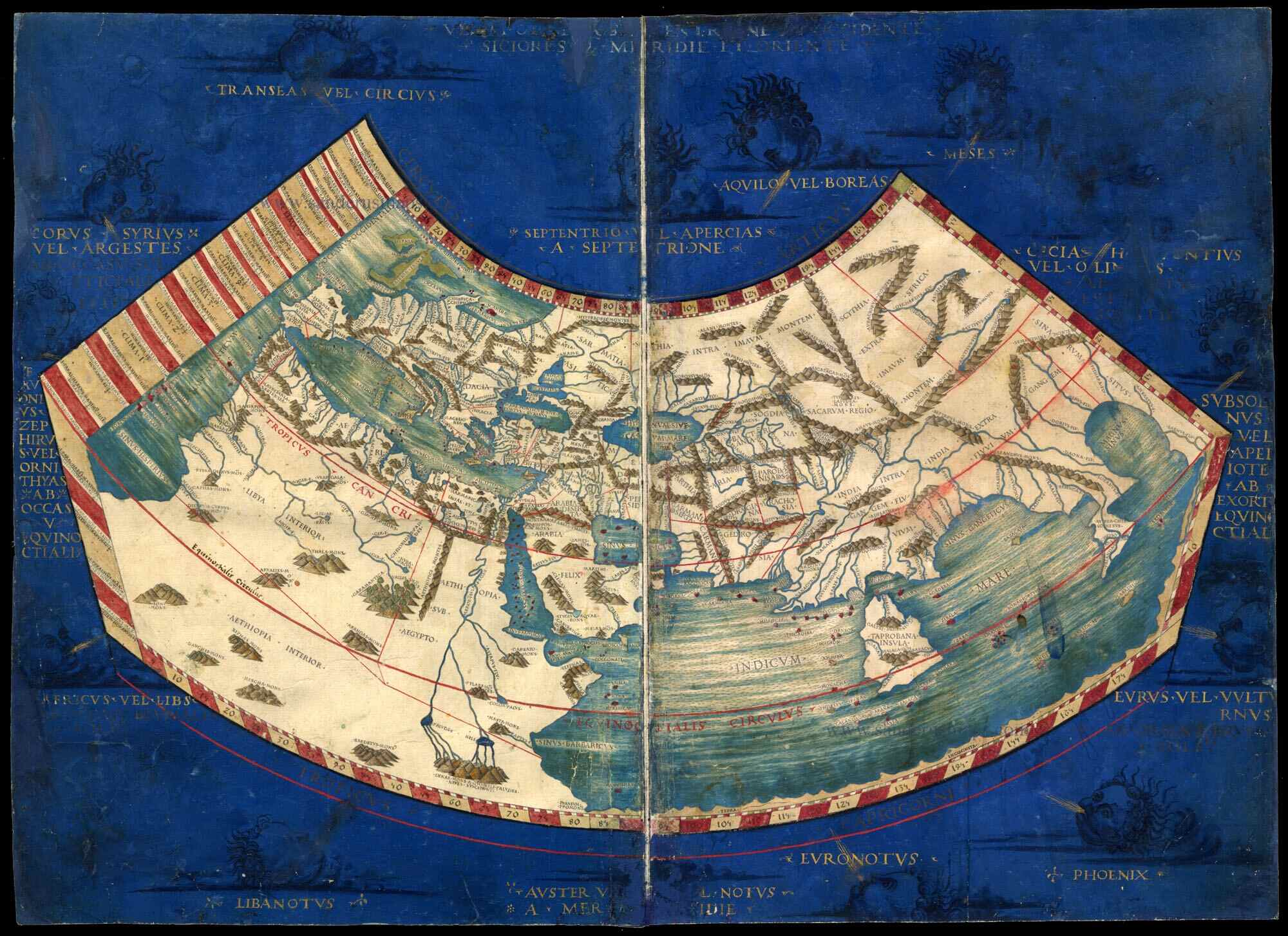
Ptolemy, a Greek-Egyptian scholar, wrote "Geographia" in the 2nd century CE. This work included maps and a detailed description of the world's geography as known to the Romans.
-
The Tabula Rogeriana, created by Arab geographer Al-Idrisi in 1154, was one of the most advanced medieval world maps. It combined knowledge from Europe, Africa, and Asia.
-
Chinese cartographers were also advanced in map-making. The Pei Xiu map from the 3rd century CE is one of the earliest known Chinese maps, showcasing detailed topographical features.
-
The Peutinger Table, a Roman road map, dates back to the 4th century CE. It illustrates the vast network of Roman roads stretching across Europe, North Africa, and the Middle East.
-
Medieval European maps often depicted Jerusalem at the center of the world. These maps, known as T and O maps, divided the world into three continents: Asia, Europe, and Africa.
-
The Ebstorf Map, created in the 13th century, was one of the largest medieval world maps. Unfortunately, it was destroyed during World War II, but copies and descriptions remain.
-
The Hereford Mappa Mundi, created around 1300, is one of the most famous medieval maps. It is housed in Hereford Cathedral in England and measures 1.58 by 1.34 meters.
Techniques and Materials Used in Ancient Maps
Understanding the techniques and materials used in creating ancient maps can provide insight into the craftsmanship and knowledge of early cartographers.
-
Early maps were often drawn on clay tablets, papyrus, parchment, or silk. Each material had its advantages and limitations.
-
Ancient cartographers used various tools, including compasses, rulers, and dividers, to create accurate maps. These tools helped them measure distances and angles.
-
Many ancient maps were hand-drawn and colored using natural pigments. These pigments were derived from minerals, plants, and insects.
-
The use of grids and coordinates was an essential technique in ancient cartography. Ptolemy's maps, for example, used a grid system to represent latitude and longitude.
-
Some ancient maps included detailed illustrations of landmarks, animals, and mythical creatures. These illustrations added visual interest and conveyed information about the mapped regions.
-
Portolan charts, used by medieval sailors, were highly detailed nautical maps. They featured coastlines, harbors, and navigational routes, often drawn on vellum.
-
The use of scale was crucial in ancient maps. Cartographers used various methods to represent scale, such as bar scales and verbal descriptions.
-
Many ancient maps were created for specific purposes, such as trade, exploration, or military campaigns. These maps often included detailed information relevant to their intended use.
-
Some ancient maps were created as part of larger works, such as atlases or geographical treatises. These collections provided comprehensive information about the known world.
-
The accuracy of ancient maps varied widely. Some maps were highly accurate, while others were more symbolic or artistic representations of the world.
Cultural and Historical Significance of Ancient Maps
Ancient maps are not just geographical tools; they also reflect the cultural and historical context in which they were created.
-
Maps often depicted the world as understood by the mapmaker's culture. For example, medieval European maps often placed Jerusalem at the center of the world.
-
Many ancient maps included religious and mythological elements. These elements reflected the beliefs and values of the societies that created them.
-
Ancient maps were often used as political tools. Rulers and empires used maps to assert control over territories and demonstrate their power.
-
Trade routes were a common feature on ancient maps. These routes connected different regions and facilitated the exchange of goods, ideas, and cultures.
-
Some ancient maps were created as gifts or diplomatic offerings. These maps symbolized alliances and conveyed valuable geographical information.
-
The spread of cartographic knowledge was facilitated by the exchange of maps between different cultures. This exchange helped to improve the accuracy and detail of maps over time.
-
Ancient maps often included detailed descriptions and annotations. These annotations provided additional information about the mapped regions, such as climate, resources, and inhabitants.
-
The study of ancient maps, known as historical cartography, is a valuable field of research. It helps historians and geographers understand how early civilizations viewed and interacted with their world.
-
Many ancient maps have been preserved in libraries, museums, and archives. These institutions play a crucial role in preserving and studying these historical artifacts.
-
The interpretation of ancient maps requires a multidisciplinary approach. Historians, geographers, archaeologists, and linguists all contribute to understanding these complex documents.
Modern Discoveries and Research on Ancient Maps
Recent discoveries and ongoing research continue to shed light on the mysteries of ancient maps.
-
Advances in technology, such as digital imaging and geographic information systems (GIS), have revolutionized the study of ancient maps. These tools allow researchers to analyze maps in new and innovative ways.
-
Some ancient maps have been discovered in unexpected places, such as shipwrecks, tombs, and hidden archives. These discoveries provide valuable insights into the history of cartography.
-
The study of ancient maps often involves deciphering old scripts and languages. This process requires expertise in paleography and historical linguistics.
-
Researchers have used ancient maps to reconstruct historical landscapes and environments. These reconstructions help to understand how ancient civilizations interacted with their surroundings.
-
The preservation of ancient maps is an ongoing challenge. Conservation efforts aim to protect these fragile documents from damage and deterioration, ensuring they can be studied and appreciated for generations to come.
Ancient Maps: A Glimpse into History
Ancient world maps offer a fascinating peek into how early civilizations viewed their surroundings. These maps weren't just tools for navigation; they were reflections of culture, beliefs, and knowledge. From the Babylonian clay tablets to the intricate Ptolemaic maps, each one tells a unique story. They reveal how people understood geography, astronomy, and even mythology.
Studying these maps helps us appreciate the progress made in cartography and the human quest for knowledge. They remind us of the ingenuity and curiosity that drove explorers and scholars. So next time you look at a modern map, remember the rich history behind it. Ancient maps are more than just old drawings; they're windows into the minds of our ancestors. They show us where we've been and inspire us to keep exploring.
Frequently Asked Questions
Was this page helpful?
Our commitment to delivering trustworthy and engaging content is at the heart of what we do. Each fact on our site is contributed by real users like you, bringing a wealth of diverse insights and information. To ensure the highest standards of accuracy and reliability, our dedicated editors meticulously review each submission. This process guarantees that the facts we share are not only fascinating but also credible. Trust in our commitment to quality and authenticity as you explore and learn with us.