


Big data is transforming geographic research in ways previously unimaginable. Ever wondered how scientists predict natural disasters or track climate change? Big data plays a crucial role. With massive amounts of information collected from satellites, sensors, and social media, researchers can analyze patterns and trends with incredible precision. This data helps in urban planning, environmental conservation, and even disaster management. Imagine predicting a hurricane's path or understanding migration patterns of endangered species. Big data makes it possible. By harnessing this wealth of information, geographers can make more informed decisions, ultimately benefiting society. Ready to dive into the world of big data in geographic research? Let's explore 39 fascinating facts that highlight its impact and potential.
Big Data's Role in Geographic Research
Big data has revolutionized many fields, and geographic research is no exception. The ability to analyze vast amounts of data has opened new doors for understanding our world. Here are some fascinating facts about how big data is transforming geographic research.
-
Big data helps predict natural disasters. Advanced algorithms analyze patterns in weather data, helping predict hurricanes, earthquakes, and floods.
-
Urban planning benefits from big data. Cities use data from traffic sensors, social media, and other sources to improve infrastructure and services.
-
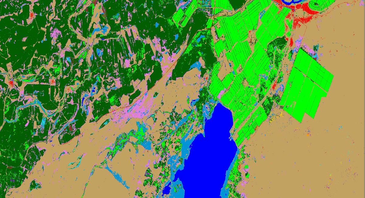
Environmental monitoring is more accurate. Satellite imagery and sensor data track changes in forests, oceans, and the atmosphere.
-
Wildlife conservation uses big data. GPS tracking and remote sensing help monitor animal populations and their habitats.
-
Agriculture becomes more efficient. Farmers use data on soil conditions, weather, and crop health to optimize yields.
Data Collection Techniques
Collecting data is the first step in geographic research. Various techniques are employed to gather the necessary information.
-
Remote sensing is widely used. Satellites and drones capture images and data from the Earth's surface.
-
Crowdsourcing contributes valuable data. People share information through apps and social media, providing real-time updates.
-
Sensor networks gather environmental data. Devices measure temperature, humidity, and other factors in different locations.
-
Geographic Information Systems (GIS) store and analyze data. GIS integrates various data types for comprehensive analysis.
-
Mobile data offers insights into human behavior. Cell phone data reveals movement patterns and social interactions.
Analyzing Geographic Data
Once data is collected, it needs to be analyzed to extract meaningful insights. This involves various methods and tools.
-
Machine learning identifies patterns. Algorithms detect trends and anomalies in large datasets.
-
Spatial analysis examines relationships. Researchers study how different geographic elements interact.
-
Predictive modeling forecasts future events. Models estimate the likelihood of various scenarios.
-
Data visualization makes complex data understandable. Maps, graphs, and charts present information in an accessible way.
-
Big data platforms handle vast amounts of information. Technologies like Hadoop and Spark process and store large datasets.
Applications in Climate Change Research
Big data plays a crucial role in understanding and addressing climate change. It helps scientists track changes and predict future impacts.
-
Climate models use big data. Simulations predict temperature changes, sea level rise, and other effects.
-
Carbon footprint analysis relies on data. Researchers measure emissions from various sources to develop reduction strategies.
-
Renewable energy planning benefits from data. Wind and solar power projects use data to optimize locations and efficiency.
-
Deforestation monitoring uses satellite data. Images track changes in forest cover over time.
-
Ocean health is monitored with big data. Sensors and satellites measure temperature, acidity, and other factors.
Social and Economic Impacts
Big data in geographic research also has significant social and economic implications. It helps address various challenges and improve quality of life.
-
Public health benefits from geographic data. Data tracks disease outbreaks and helps plan healthcare services.
-
Disaster response is more effective. Real-time data guides emergency services and resource allocation.
-
Economic development uses geographic data. Businesses analyze location data to make investment decisions.
-
Transportation planning relies on data. Traffic patterns and public transit usage inform infrastructure projects.
-
Education and research are enhanced. Students and researchers access vast datasets for their studies.
Ethical Considerations
The use of big data in geographic research raises important ethical questions. It's crucial to address these issues to ensure responsible use.
-
Privacy concerns are significant. Protecting personal information is a major challenge.
-
Data accuracy is essential. Inaccurate data can lead to wrong conclusions and decisions.
-
Bias in data collection and analysis. Ensuring diversity and fairness in data is important.
-
Transparency in data use. Clear communication about how data is collected and used builds trust.
-
Access to data. Ensuring that data is available to all researchers promotes equity.
Future Trends in Big Data and Geographic Research
The field of geographic research continues to evolve, with new trends and technologies emerging.
-
Artificial intelligence will play a bigger role. AI will enhance data analysis and predictive modeling.
-
Integration of different data sources. Combining data from various sources will provide more comprehensive insights.
-
Real-time data analysis. Faster processing will enable immediate insights and responses.
-
Increased use of drones. Drones will capture more detailed and frequent data.
-
Enhanced data visualization tools. New tools will make it easier to understand complex data.
Challenges in Big Data for Geographic Research
Despite its benefits, using big data in geographic research comes with challenges that need to be addressed.
-
Data storage and management. Handling large volumes of data requires advanced infrastructure.
-
Interoperability of data systems. Ensuring different systems can work together is crucial.
-
Skill gaps in data analysis. Training researchers in data science is essential.
-
Cost of data collection and analysis. High costs can be a barrier for some projects.
The Power of Big Data in Geographic Research
Big data has transformed geographic research. It offers insights that were once unimaginable. From tracking climate change to urban planning, the applications are endless. Researchers can now analyze vast amounts of information quickly, leading to more accurate predictions and solutions.
Big data also helps in disaster management. By analyzing patterns, authorities can better prepare for natural disasters, potentially saving lives. Additionally, it plays a crucial role in environmental conservation. Tracking wildlife movements and deforestation rates becomes easier and more precise.
The integration of big data with geographic research is not just a trend; it's a necessity. As our world becomes more complex, the need for detailed, accurate data grows. Embracing big data in geographic research means better decisions, smarter planning, and a deeper understanding of our planet. The future of geographic research is bright, thanks to the power of big data.
Was this page helpful?
Our commitment to delivering trustworthy and engaging content is at the heart of what we do. Each fact on our site is contributed by real users like you, bringing a wealth of diverse insights and information. To ensure the highest standards of accuracy and reliability, our dedicated editors meticulously review each submission. This process guarantees that the facts we share are not only fascinating but also credible. Trust in our commitment to quality and authenticity as you explore and learn with us.