


Geostationary satellites are fascinating pieces of technology orbiting our planet. Ever wondered how your satellite TV works or how weather forecasts are so accurate? These satellites play a crucial role. Positioned about 22,236 miles above the equator, they orbit Earth at the same rate it rotates. This means they stay in a fixed spot relative to the surface, providing consistent communication signals and weather data. But there's more to these high-tech marvels than meets the eye. From their launch process to their lifespan, geostationary satellites have many intriguing aspects. Ready to learn 36 amazing facts about them? Buckle up!
What is a Geostationary Orbit?
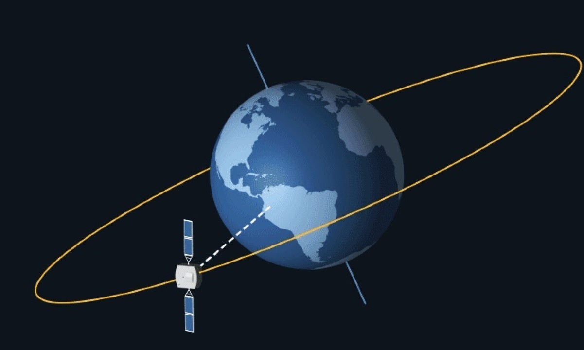
A geostationary orbit is a unique type of orbit that allows a satellite to remain in a fixed position relative to the Earth's surface. This orbit is crucial for various applications, including communications, weather monitoring, and broadcasting.
- Altitude: Geostationary orbits are located approximately 35,786 kilometers (22,236 miles) above the Earth's equator.
- Orbital Period: Satellites in geostationary orbit complete one orbit around Earth every 24 hours, matching the Earth's rotation period.
- Fixed Position: Because they orbit at the same rate the Earth rotates, these satellites appear stationary from the ground.
- Equatorial Plane: Geostationary orbits must be directly above the equator to maintain their fixed position.
- Communication: Many communication satellites use geostationary orbits to provide consistent coverage to specific areas.
- Weather Monitoring: Weather satellites in geostationary orbit can continuously monitor weather patterns over large areas.
Historical Background of Geostationary Orbits
The concept of geostationary orbits has a fascinating history, dating back to visionary ideas and technological advancements.
- Arthur C. Clarke: The idea of geostationary satellites was popularized by science fiction writer Arthur C. Clarke in 1945.
- First Satellite: The first successful geostationary satellite, Syncom 3, was launched by NASA in 1964.
- Early Uses: Initially, geostationary satellites were used primarily for communication purposes.
- Global Coverage: By the 1970s, a network of geostationary satellites provided near-global communication coverage.
- Technological Advances: Advances in rocket technology and satellite design have made geostationary orbits more accessible.
Applications of Geostationary Satellites
Geostationary satellites serve a wide range of purposes, from communication to environmental monitoring.
- Television Broadcasting: Many TV channels rely on geostationary satellites to broadcast signals to homes worldwide.
- Internet Services: Some internet service providers use geostationary satellites to offer connectivity in remote areas.
- Weather Forecasting: Satellites like GOES (Geostationary Operational Environmental Satellite) provide real-time weather data.
- Disaster Management: Geostationary satellites help monitor natural disasters like hurricanes and wildfires.
- Navigation: Some navigation systems use geostationary satellites to enhance accuracy.
- Military Use: Armed forces utilize these satellites for secure communication and reconnaissance.
Technical Challenges and Solutions
Maintaining a satellite in geostationary orbit involves overcoming several technical challenges.
- Launch Costs: Sending a satellite to geostationary orbit is expensive due to the high altitude required.
- Orbital Slots: The geostationary belt has limited space, leading to competition for orbital slots.
- Signal Delay: Communication signals experience a delay due to the long distance between the satellite and Earth.
- Radiation: Satellites in geostationary orbit are exposed to higher levels of radiation, which can damage electronics.
- Station-Keeping: Satellites must use onboard thrusters to maintain their precise position.
- End-of-Life Disposal: Decommissioned satellites are moved to a "graveyard orbit" to avoid collisions.
Future of Geostationary Satellites
The future of geostationary satellites looks promising with ongoing innovations and new applications.
- Electric Propulsion: New satellites are using electric propulsion systems for more efficient station-keeping.
- Smaller Satellites: Advances in miniaturization are leading to smaller, more cost-effective geostationary satellites.
- High Throughput Satellites (HTS): HTS technology increases data capacity, improving internet and communication services.
- Environmental Monitoring: Future satellites will provide even more detailed data on climate change and environmental conditions.
- Space Debris Management: Efforts are underway to manage and reduce space debris in geostationary orbit.
- Inter-Satellite Links: Future networks may use inter-satellite links for faster and more reliable communication.
Interesting Facts About Geostationary Orbits
Here are some intriguing tidbits about geostationary orbits that highlight their unique characteristics.
- Orbital Speed: Satellites in geostationary orbit travel at approximately 3.07 kilometers per second (1.91 miles per second).
- Coverage Area: A single geostationary satellite can cover about one-third of the Earth's surface.
- Weather Satellites: The first weather satellite in geostationary orbit, ATS-1, was launched in 1966.
- Solar Panels: Geostationary satellites rely heavily on solar panels for power, as they receive constant sunlight.
- International Cooperation: Countries often collaborate on geostationary satellite projects to share costs and benefits.
- Satellite Lifespan: The typical lifespan of a geostationary satellite is 10-15 years, after which they are moved to a graveyard orbit.
- Spacecraft Design: Geostationary satellites are designed to withstand harsh space conditions, including extreme temperatures and radiation.
Final Thoughts on Geostationary Satellites
Geostationary satellites play a crucial role in modern communication, weather forecasting, and global navigation. Positioned 35,786 kilometers above the equator, these satellites match Earth's rotation, providing consistent coverage over specific areas. This unique orbit allows for uninterrupted data transmission, making them indispensable for TV broadcasts, internet services, and emergency communications.
Their ability to monitor weather patterns and natural disasters helps save lives and property. By providing real-time data, they enable accurate weather predictions and timely warnings. Additionally, geostationary satellites support GPS systems, ensuring precise navigation for everything from smartphones to airplanes.
Understanding the importance of these satellites highlights their impact on daily life. From staying connected to staying safe, geostationary satellites are silent guardians in the sky, working tirelessly to keep our world running smoothly.
Was this page helpful?
Our commitment to delivering trustworthy and engaging content is at the heart of what we do. Each fact on our site is contributed by real users like you, bringing a wealth of diverse insights and information. To ensure the highest standards of accuracy and reliability, our dedicated editors meticulously review each submission. This process guarantees that the facts we share are not only fascinating but also credible. Trust in our commitment to quality and authenticity as you explore and learn with us.