


Tropical Storm Chantal might not be a name you hear often, but it has made its mark in meteorological history. Did you know that Chantal has appeared multiple times in the Atlantic hurricane season? This storm has a knack for surprising meteorologists with its unpredictable paths and varying intensities. From its formation to its dissipation, Chantal has impacted numerous coastal regions, bringing heavy rains, strong winds, and sometimes even flooding. Understanding the history and behavior of Tropical Storm Chantal can help us better prepare for future storms. Let's dive into 40 intriguing facts about this fascinating weather phenomenon!
Formation and Early Development
Tropical Storm Chantal has an interesting history, beginning with its formation and early stages. Here are some fascinating facts about how it all started.
-
Chantal originated from a tropical wave that moved off the west coast of Africa. This wave traveled across the Atlantic Ocean, gradually gaining strength and organization.
-
The storm was first identified on July 7, 2013. Meteorologists began tracking the system as it showed signs of developing into a tropical cyclone.
-
Chantal became a tropical storm on July 8, 2013. It quickly intensified, reaching tropical storm status just a day after being identified.
-
The storm's name, Chantal, was chosen from a pre-determined list of names. The World Meteorological Organization maintains this list, rotating names every six years.
Path and Movement
The journey of Tropical Storm Chantal across the Atlantic and Caribbean was both unpredictable and intriguing. Let's explore its path and movement.
-
Chantal moved westward across the Atlantic Ocean. The storm followed a general westward track, influenced by the subtropical ridge to its north.
-
The storm passed through the Lesser Antilles on July 9, 2013. It brought heavy rain and strong winds to several islands, including Barbados and St. Lucia.
-
Chantal entered the Caribbean Sea on July 10, 2013. The storm continued its westward movement, affecting more islands in the region.
-
The storm's forward speed was unusually fast. Chantal moved at speeds of up to 29 mph, which is quite rapid for a tropical storm.
Impact on Affected Areas
Tropical Storm Chantal had significant effects on the regions it passed through. Here are some key impacts of the storm.
-
Barbados experienced heavy rainfall and strong winds. The storm caused flooding and power outages across the island.
-
St. Lucia reported landslides and road closures. The heavy rain triggered landslides, making travel difficult and dangerous.
-
Dominica faced widespread flooding. Rivers overflowed, inundating homes and businesses in low-lying areas.
-
Haiti and the Dominican Republic were put on high alert. Authorities prepared for potential impacts, including flooding and landslides.
Meteorological Characteristics
Understanding the meteorological aspects of Tropical Storm Chantal provides insight into its behavior and intensity.
-
Chantal had a peak intensity of 65 mph. The storm reached this maximum sustained wind speed on July 9, 2013.
-
The storm's minimum central pressure was 1005 millibars. This relatively low pressure contributed to its strength as a tropical storm.
-
Chantal exhibited a well-defined circulation. Satellite imagery showed a distinct center of circulation, characteristic of a tropical storm.
-
The storm's convection was concentrated near its center. This centralization of thunderstorms is typical of tropical cyclones.
Dissipation and Aftermath
Every storm eventually loses strength and dissipates. Here's what happened to Chantal as it weakened and its aftermath.
-
Chantal began to weaken on July 10, 2013. Interaction with land and unfavorable atmospheric conditions contributed to its decline.
-
The storm was downgraded to a tropical depression on July 11, 2013. It lost much of its organization and intensity.
-
Chantal dissipated on July 12, 2013. The remnants of the storm continued to produce rain and thunderstorms, but it was no longer a tropical cyclone.
-
The storm's remnants affected the Bahamas. Even after dissipation, Chantal's remnants brought rain and gusty winds to the region.
Historical Context
Placing Tropical Storm Chantal within a broader historical context helps us understand its significance.
-
Chantal was the third named storm of the 2013 Atlantic hurricane season. It followed Tropical Storm Andrea and Tropical Storm Barry.
-
The 2013 season was relatively quiet. There were fewer storms and hurricanes compared to other years, making Chantal one of the more notable events.
-
Chantal's rapid movement was unusual. Most tropical storms move at slower speeds, making Chantal's fast pace noteworthy.
-
The storm's impacts were relatively mild compared to stronger hurricanes. While Chantal caused damage, it was not as severe as more powerful storms.
Preparedness and Response
The response to Tropical Storm Chantal highlights the importance of preparedness in mitigating the effects of tropical cyclones.
-
Authorities issued warnings and advisories. Governments in affected areas provided timely information to residents, helping them prepare for the storm.
-
Emergency services were mobilized. Rescue teams and first responders were on standby to assist with any emergencies.
-
Evacuation plans were put into place. In some areas, residents were advised to evacuate to safer locations.
-
Public awareness campaigns were conducted. Information about the storm and safety measures was disseminated through various media channels.
Environmental Impact
Tropical storms can have significant environmental effects. Here are some ways Chantal impacted the natural environment.
-
Heavy rainfall led to soil erosion. The intense rain washed away topsoil, affecting agriculture and natural habitats.
-
Flooding altered river courses. Overflowing rivers changed their paths, impacting ecosystems and human settlements.
-
Landslides damaged vegetation. The movement of soil and rocks destroyed plant life in affected areas.
-
Marine environments were affected by runoff. Floodwaters carried debris and pollutants into the ocean, impacting marine life.
Lessons Learned
Every storm provides valuable lessons for future preparedness and response. Here are some takeaways from Tropical Storm Chantal.
-
Early warning systems are crucial. Timely alerts helped minimize the storm's impact on human life and property.
-
Community preparedness can save lives. Educating residents about storm safety measures proved effective in reducing casualties.
-
Infrastructure resilience is important. Strengthening buildings and infrastructure can help withstand storm impacts.
-
Environmental conservation can mitigate damage. Protecting natural barriers like mangroves and wetlands can reduce the effects of flooding and erosion.
Interesting Tidbits
Here are some lesser-known facts and interesting tidbits about Tropical Storm Chantal.
-
Chantal's name was retired after the 2013 season. Due to its impact, the name was replaced with "Claudette" for future seasons.
-
The storm's rapid movement puzzled meteorologists. Researchers studied Chantal to understand the factors behind its unusual speed.
-
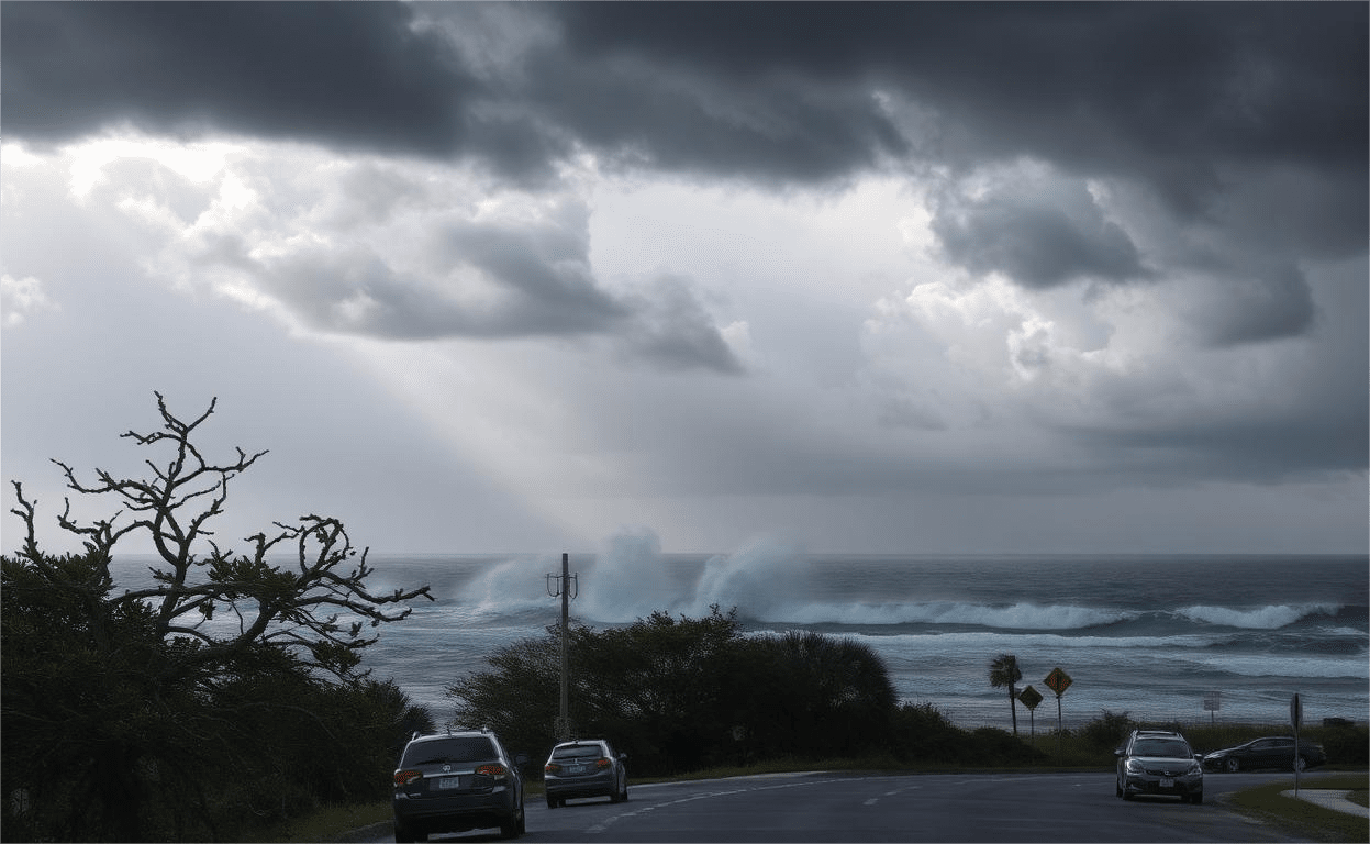
Chantal's remnants contributed to rainfall in the southeastern United States. The leftover moisture from the storm brought rain to parts of Florida and Georgia.
-
The storm's data helped improve forecasting models. Information gathered from Chantal was used to enhance the accuracy of future storm predictions.
Final Thoughts on Tropical Storm Chantal
Tropical Storm Chantal, though not the most powerful storm, left its mark. It formed in the Atlantic, traveled across the ocean, and brought heavy rain and strong winds to several regions. Chantal's journey reminds us of the unpredictable nature of weather and the importance of staying informed during hurricane season.
From its formation to its dissipation, Chantal's path was closely monitored by meteorologists, providing valuable data for future storm predictions. Understanding these storms helps communities prepare better and minimize damage.
Whether you're a weather enthusiast or just curious, knowing about storms like Chantal can be both fascinating and educational. Stay safe, stay informed, and always keep an eye on the weather updates during hurricane season.
Was this page helpful?
Our commitment to delivering trustworthy and engaging content is at the heart of what we do. Each fact on our site is contributed by real users like you, bringing a wealth of diverse insights and information. To ensure the highest standards of accuracy and reliability, our dedicated editors meticulously review each submission. This process guarantees that the facts we share are not only fascinating but also credible. Trust in our commitment to quality and authenticity as you explore and learn with us.